The Grand Canyon State is grand-slam adventure. One of the best road trips in America. That’s because you can hit so many epic landscapes in a very short amount of time. How many places can you see? Well, by my estimate, you can hit at least ten different points of interests.
Disclaimer: This post contains affiliate links. If you book or buy something through these links, I earn a small commission (at no extra cost to you).
If you love the outdoors and adventure; Arizona, Utah and Las Vegas were made for you. Depending on your pace and length of stay, depends on how many sites you can visit. If you can’t hit all of them, don’t worry, all the more reason to come back and visit again!
Preparing for a Journey
It’s possible to do this trip in just seven days but I’d recommend at least eight. Eight days is appropriate for most itineraries. At the end of the blog I’ll make sure to list some sample itineraries so you know what to expect. If your flying in from out of town, remember to use Skyscanner to search for cheap flights. The results of your findings could lead you to start in either Las Vegas Nevada or Phoenix Arizona.
If you didn’t guess it already by the title of the blog, I chose to fly into Phoenix and drive through the southwest part of Utah to reach Las Vegas.
Picking up a Rental Car at Phoenix Sky Harbor Airport
So, if you find yourself landing in Phoenix, you will want to get a rental car right away to get on the road. Ideally, you will want to arrive early so you have the entire day to get your road trip started.
Pro Tip: Upon getting off the plane, don’t use the nearest bathroom unless you really need to go. Use the bathroom in the plane before landing instead. It might save you 30min in the rental car line.
Technically, you don’t pick up the rental car at the airport. Instead, you get shuttled ten minutes outside the airport to the car rental hub. It’s actually very organized and makes a lot of sense. I’ve been to a lot of airports and some are just a mess to find and pick up a rental car. This was easy breezy.
So, now that you have your rental car keys in hand, set you GPS before leaving the parking garage to Red Rock State Park. The drive should take approximately two and a half hours, but the drive is much faster due to the open highway and Arizona landscape. Once you head north out of Phoenix, it doesn’t take long to see plenty of cacti, rolling hills, diamondbacks and sunshine.
Red Rock State Park
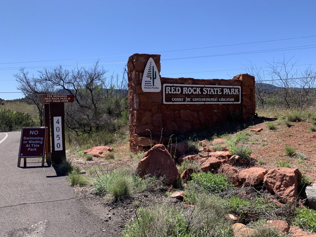
Upon arriving at Red Rock State Park, make sure to take that selfie because you aren’t actually someplace unless its on social media. Just kidding! But, this is the perfect spot to stretch your legs for a little bit from the car ride. At just $7 per person, the park is cheap, relatively speaking. I’d plan on only spending about an hour or so here and two hours max. Talk to the park rangers and find the best trail route for you and take the map with. Enjoy the leisurely stroll and open air. One of the highlights is seeing Cathedral Rock. You won’t be able to get close to it, but you can see its beauty from afar.
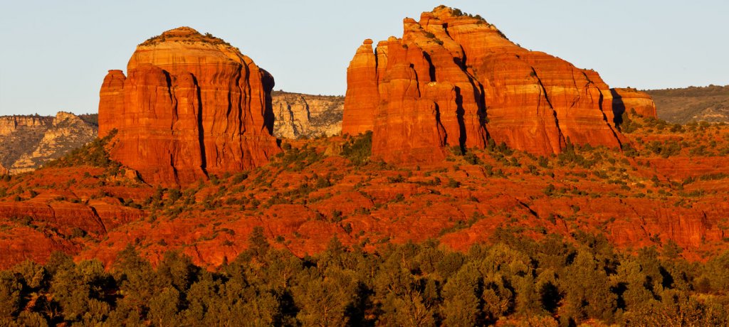
Red Rock State Park is a 286 acre nature preserve and environmental education center with stunning scenery. Trails throughout the park wind through manzanita and juniper to reach the rich banks of Oak Creek. Green meadows are framed by native vegetation and hills of red rock. The creek meanders through the park, creating a diverse riparian habitat abounding with plants and wildlife. This riparian habitat provides the setting and the opportunity for the park to offer a focus on environmental education.
Hiker Tip: Why are the rocks red?
A: Because they contain a bit of iron … they are rusting!
Red Rock offers a variety of special programs for school groups and private groups. There are a number of daily and weekly park events. The park offers a visitors center, classroom, theater, park store, ramada and hiking trails.
When you’ve had enough, make sure to hit the bathroom and grab some extra water from the drinking fountain at the Miller Visitor’s Center.
Red Rock State Park Visitor Center
The gift shop, located inside the Visitor Center, offers a wide selection of souvenirs, including t-shirts, magnets, walking sticks, books, maps, and postcards that highlight the Sedona area. Beverages and snacks are also for sale.
There are many educational opportunities found at the Visitor Center. The hands-on exhibits are based on the theme of biotic communities. The panels bring to life the variety of habitats found within the park. You will also find information on the early human inhabitants of the area as well as roving displays showing a wide selection of the park’s wildlife. The center also features a small movie theater at the park which shows “The Natural Wonders of Sedona: Timeless Beauty.” The 45-minute film plays on request and covers Sedona’s history and wildlife and takes you on a flying tour of the red rocks providing you with some phenomenal aerial scenes.
If you don’t want to stay for the movies, I wouldn’t blame you. The day has just begun and you’ve got a lot of ground to make up.
Devil’s Bridge Trail
What is a hop and a skip away, thirty minutes down the road and you’ll find the head of the Devil’s Bridge trail. If you only have a low clearance vehicle, you can park at the Dry Creek Road trail head at the paved section, approximately 1 mile from trail head, or at the Mescal trail head located on Long Canyon Road.
Depending on where you park, you have a few routes to choose from to access Devils Bridge Trail, including the unpaved portion of Dry Creek Road, Chuckwagon Trail, or Mescal to Chuckwagon Trail. From the parking area off of the unpaved portion of Dry Creek Road, follow the trailmarker for Devil’s Bridge Trail. The early portion of the trail was originally a jeep trail so it is smooth and traverses through washes filled with juniper and prickly pear cactus.

Devils Bridge is the largest natural sandstone arch located in the Sedona area of the Coconino National Forest. The trail is a very popular hike that offers breathtaking views of Red Rock country. It is a steep, but short hike. The path gently inclines uphill and gets steeper as you continue on. About 3/4 of a mile from the parking area the trail will come to a fork and you will go left. Here you’ll end up at the base of the bridge. You will then continue up a natural rock staircase from which there are beautiful views. You will reach another level of stairs which will take you up to the bridge.
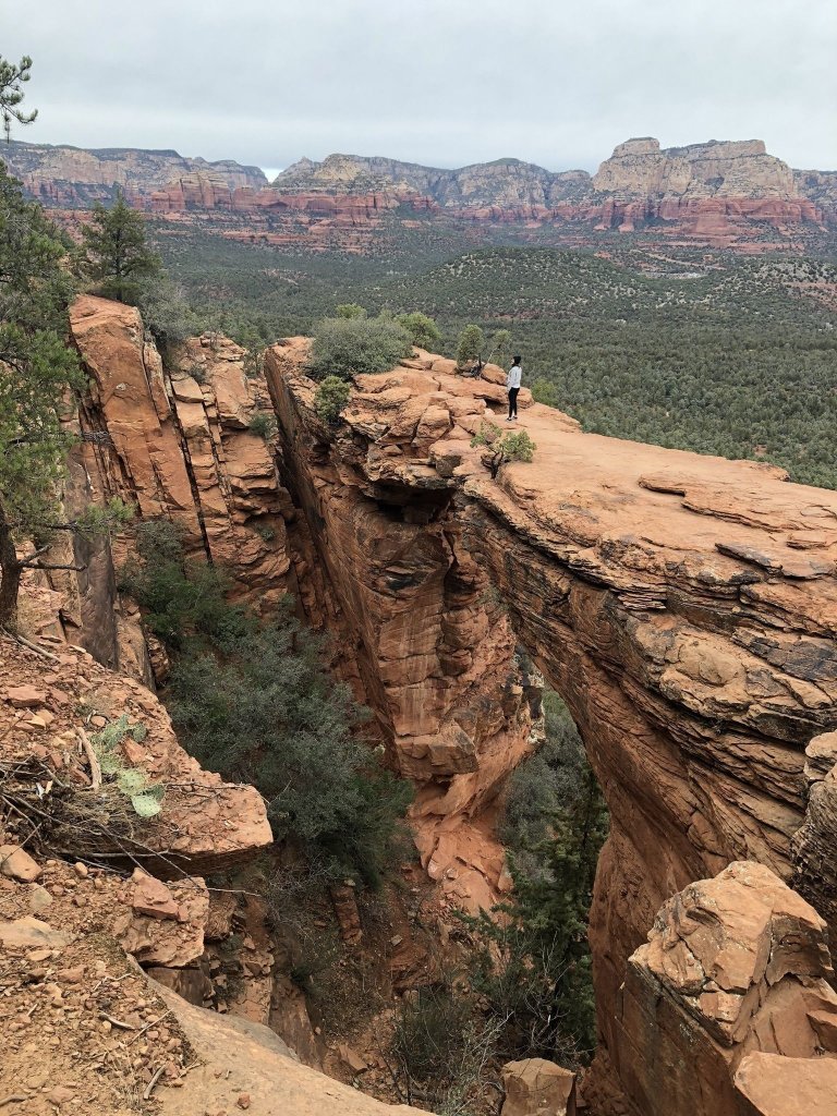
This popular trail is certainly a tourist attraction so make sure to arrive early to avoid large crowds. This is a fun hike for the whole family but make sure to stay aware and be safe. I love my Keen Hiking Boots for trails like this one. The last thing you want to do is twist an ankle out in the middle of nowhere.
Sedona Arizona Outlook
Now, you could easily spend two or three days in Sedona Arizona. There are plenty of things to do and see in this wonderful town. Make sure to see The Outlook while you are here, the views are amazing.
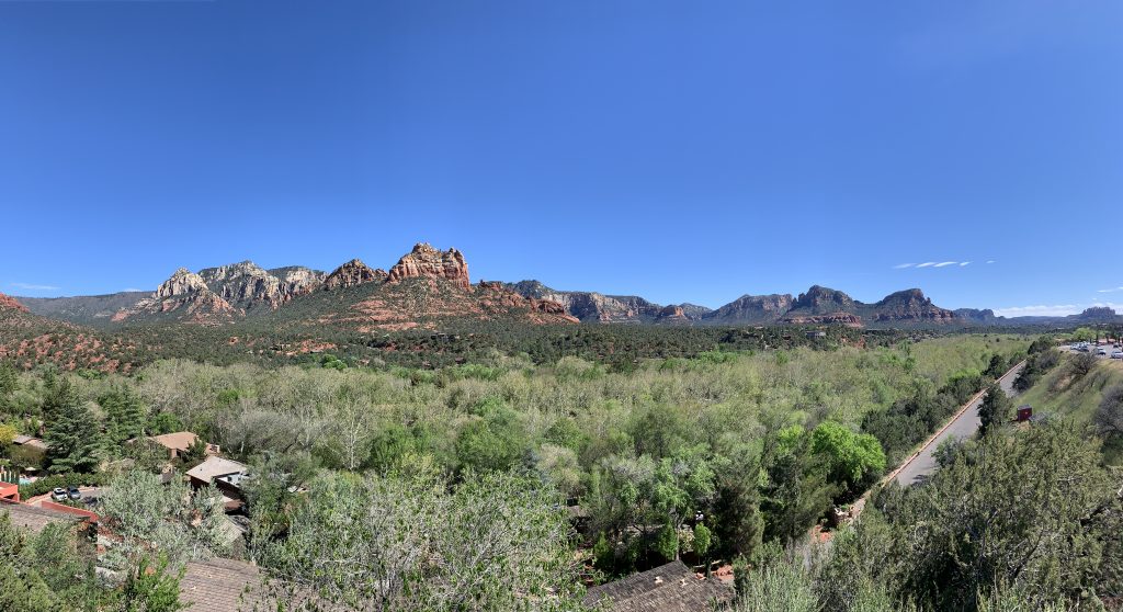
The Outlook is a popular place right beside the road that features a great view of the cascading mountains. While the picture above doesn’t do it justice, you have to see it in person. The sight of the red rock formations, the fresh air smell and the sun beating down is awesome!
The main area of downtown is quaint, cozy and cute. The brick pavers sidewalk and local shops, restaurants and a few tour excursions line the street. Flower beds, bustling shop owner staff, locals and tourists alike fill the area. It gets quite popular between lunch and mid-day so plan accordingly. You will not regret stopping in Sedona on your trip, it’s beautiful.
A popular spot to eat is an indoor-outdoor restaurant called Outlaw Grill. Get the grilled pulled pork sandwich with sweet potato fries, you won’t be disappointed. Overall, I would give the meal an 8 our of 10. There are plenty of places to choose from along the main road depending on your budget and time.
If you want some adventure, here is a short list of things to do in Sedona;
- Pink Jeep Tour
- Foodie Tour
- ATVing through the desert
- Rafting
- Horseback Riding
When you choose to leave Sedona is up to you but afterwards you should set your GPS to Flagstaff Arizona, which will be the next leg of the trip.
Native American Craft Market
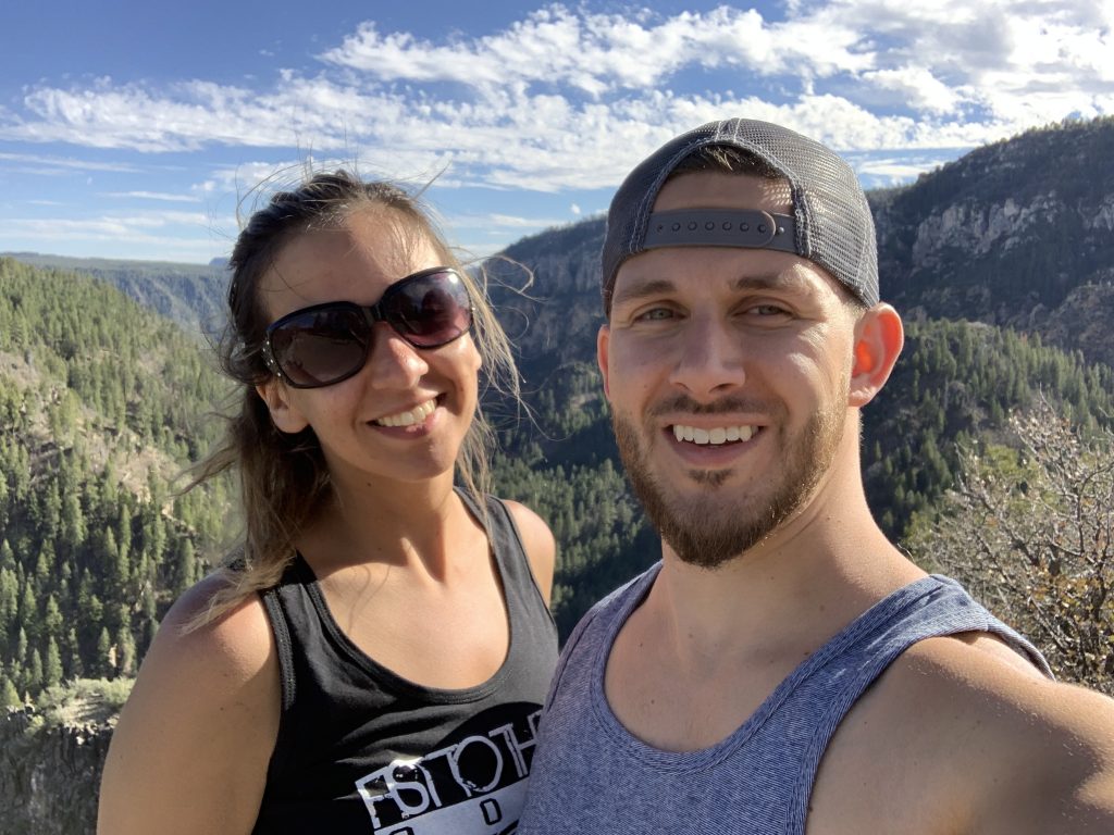
When you leave Sedona, its a nice drive on your way to Flagstaff, but you wont find many places to stop. A nice stop along the way is the Native American Craft Market. Stop here for a quick minute to stretch your legs and pick up some small souvenirs. It’s always a big win in my book to pick up something unique and creative. There are a hand-crafted arrows, dream catchers, wood carvings and much more. The stop is worthwhile and the views do not disappoint either.
Making it to Flagstaff Arizona
Located in the high country mountains of northern Arizona, Flagstaff’s four seasons are beautiful all year round. The town is surrounded by mountains, red rock formations and the nearby Grand Canyon National Park. Needless to say, there is plenty to do. And, while it warrants a two or three day itinerary, it’s just a stomping ground for an overnight stay for most.

Summer temperatures average in the low 80s with sapphire blue skies and crisp mountain air, while winter adventures await in Arizona’s officially designated Winter Wonderland with an average 108″ of snow fall in downtown.
Fall is no joke either as the leavess turn into brilliant colors of golden yellow, orange and fire engine red.
Flagstaff is touted as the “City of Seven Wonders”. Some of the most breathtaking views in America can be seen here. Here are the seven wonders:
- Grand Canyon National Park
- Wupatki National Monument
- Oak Creek Canyon
- Sunset Crater Volcano
- San Francisco Peaks
- Coconino National Forest
- Walnut Canyon
As you can see, there is plenty to do in Flagstaff Arizona and you should be able to keep busy for at least a few days. Outside of the Seven Wonders, there are still shops, restaurants and the town square to visit.
Grand Canyon National Park
From the moment I passed the entrance to Grand Canyon National Park, I knew something epic was about to happen. If you’re coming from Flagstaff, it takes about an hour and twenty minutes to reach the gates.
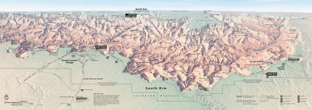
From the visitor center, head Southeast to the South Kaibab Trailhead. Here is a 3D panoramic photo to get an idea of the South Rim. Click the photo to zoom in and really take a look around before you start your journey.
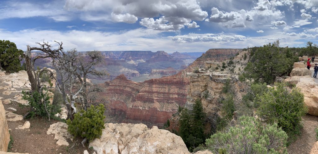
My first impressions at the canyon edge were in-explainable. The view was incredible from every angle. The ridges and the thousands of years of layers made it look like one giant mural.
The Grand Canyon is one of the most remarkable natural wonders in the world. It’s breathtaking and something that you must see for yourself. Take the kids, take grandma, take your significant other, it’s for everybody! The paths along the rim are paved, smooth and very gradual for the most part, unlike the hiking trails.
During my time there I met a few hikers who spent a full eight hours hiking up the canyon from the bottom. They started earlier that morning. I asked the hiker if the climb was worth it, big mistake. The hiker said, as he was still catching his breath, “Well…now, yes, but if you asked me fifteen minutes ago, I would’ve said hell no!”. The hikers were camping at the bottom for a couple of nights on the Colorado river and living off of noodles, beans and protein bars. Sounds like fun for somebody, but probably not me! You can catch me in an Airbnb, glamping! Ha
Grand Canon National Park has a great shuttle system that allows you to hop on and hop off the buses as you would like. Buses are generally coming around every fifteen to twenty minutes so you are not waiting too long. Hop on a bus if your legs get tired. The buses also have room for a couple of bikes if you are traveling with bikes.
Once you arrive back at the visitor area, head West along the rim to the next best viewpoint. The views are impressive on the East side but the West side completely surpasses it.
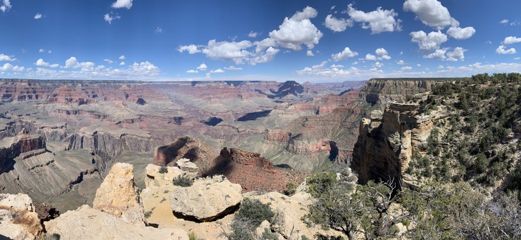
The Grand Canyon looks surreal from every angle. It’s like a masterpiece. It’s so surreal that it looks fake. Can you imagine that? It’s like you could reach out and touch the other side of the canyon as if it was a large painting hanging on a wall. But, make no mistake about it, it’s a very long way down. Please be safe when on the trails. And do stay on the designated paths. It helps preserve the park for years to come. Many have fallen victim to not following the rules. You will not survive the fall. But, on a much lighter note.
There is no place I’d rather have lunch then at the top of the Grand Canyon, so be sure to pack a picnic.
Around noon time, hopefully the sun is shinning bright, the birds chirping and only a slight crosswind. Find a great place to stop for a snack or better yet, pack a lunch and eat it at one of the many viewpoints.
A few snack places and a restaurant exist at the park if you don’t bring food with you but they are pricey. Supply and demand will have you broke before dinner. So, for the budget-travelers, stop before you enter the park and pick up some snacks and food.
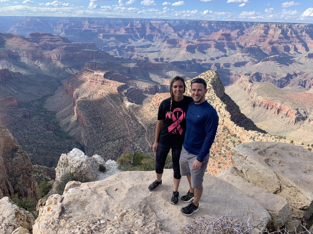
The lookout points that I recommed on the West Rim trail are;
- Maricopa
- Powell
- Hopi Point.
They all offer great views but are looking at much of the same areas. If you only had time to hit one of these lookouts on your journey, you are not missing much by skipping the other two.
Traveler Tip: There is nothing like the Grand Canyon in the world. The canyon stretches 227 miles long, one mile deep and averages ten miles wide.
Related: Grand Canyon Day Trip
Desert View Watch Tower
Your first or last stop at the Grand Canyon could be the Desert View watch tower. You can find souvenirs and some sweet treats at the small shop and don’t forget about the ice cream.
The watch tower had some of the best views of the canyon. I would highly recommend making a stop there and fit it in your plans. The watchtower itself is pretty neat as well as you can go inside of it, walk to the top and learn a little more about the history of the region. Personally, I left the watchtower feeling I got more than we bargained for, great stop!
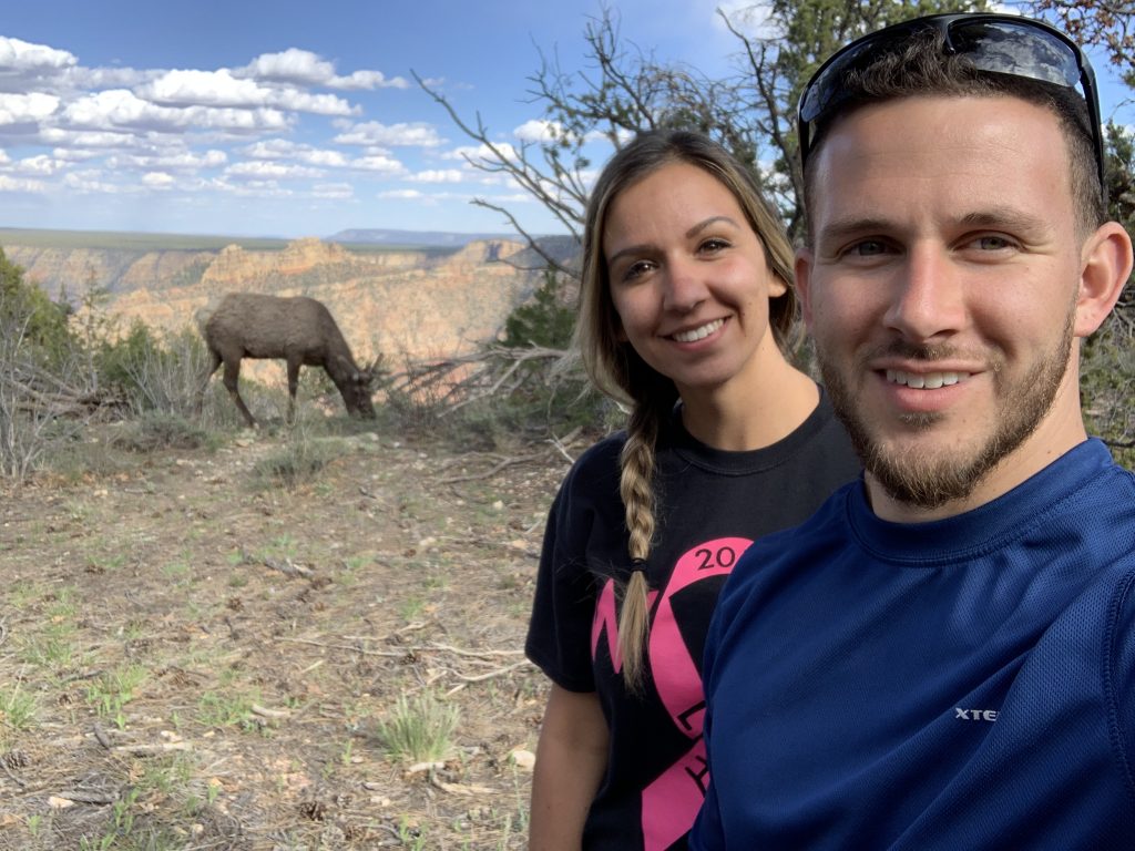
Along your Grand Canyon travels, don’t be surprised if you run into a family or Elk! These mammals are enormous in person. They seem harmless and distracted for the most part but always lean on the side of caution.
No animals were harmed in the making of this photo. Also note, the photo does not capture the sheer size of the Elk, it was still a good 30ft from us.
Antelope Canyon
Antelope Canyon is a slot canyon in the American Southwest. It includes two separate, scenic slot canyon sections, referred to as Upper Antelope Canyon, and Lower Antelope Canyon.
The drive from the South Rim of the Grand Canyon to Antelope Canyon is beautiful. Rolling sandy hills and red rock formations lined each side of the road. I loved the feeling of the windows rolled down and no traffic in site. It was great to just enjoy driving again away from the hustle and bustle of a big city.
Now, I suggest visiting the lower antelope canyon in the earlier morning hours. So, that might mean that you have to wait until the next day to make a visit. Stay within the town of Page Arizona so you don’t have more than a ten minute ride.

Viator Lower Antelope Tours
As I said, the best time to visit is in the morning when the light is magical. The sun will just start peaking through the crevices of the canyon and create drastic shadows and beams of light.
Note: If you plan on going to Antelope Canyon, you must book months in advanced.
We booked our tour very late and were lucky to get in through Viator. The cost for two of us was $100 at our preferred time slot. The ticket includes the Navajo permit and tax that you must pay to go on the land the canyon resides on.
Just an FYI, you can only visit the canyons with a guide. I would’ve really liked to explore the canyon on our own and take our own photos. The guides already know all the best spots for photos, but I would’ve appreciated some time to myself to spark my own creativity.
Note: While hiking boots are not necessary and you can get by with gym shoes, the sand can get messy and everywhere you dont want it to be. I would recommend Keen boots like these here.
Another tip before you head out for the day, you can not have any DSLR or GoPro cameras. For this, you would need to book a special photography tour. We booked the regular tour because the Photgraphy package is much pricier. To each their own I suppose. I strongly suggest a cheap wide-angle lens kit from Amazon to enhance your photos, like this one here. The wide angle lens takes great pictures in tight places.
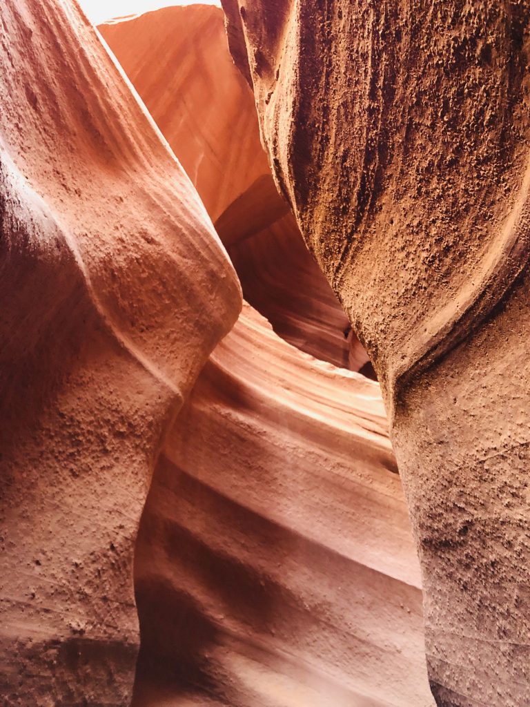
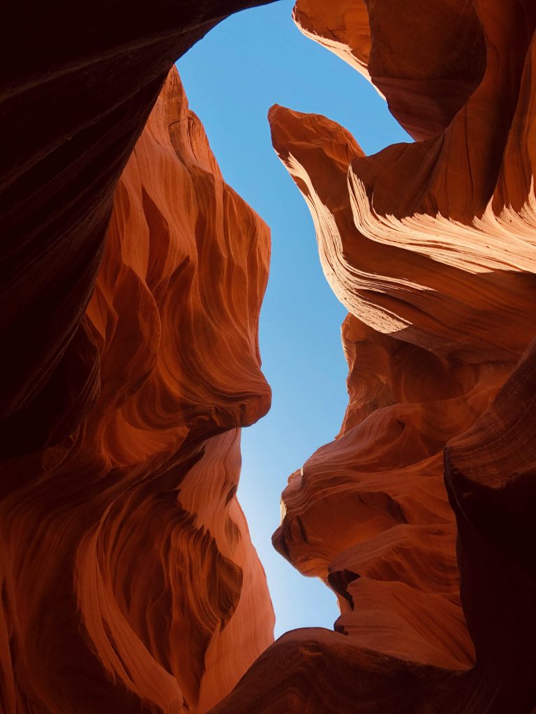
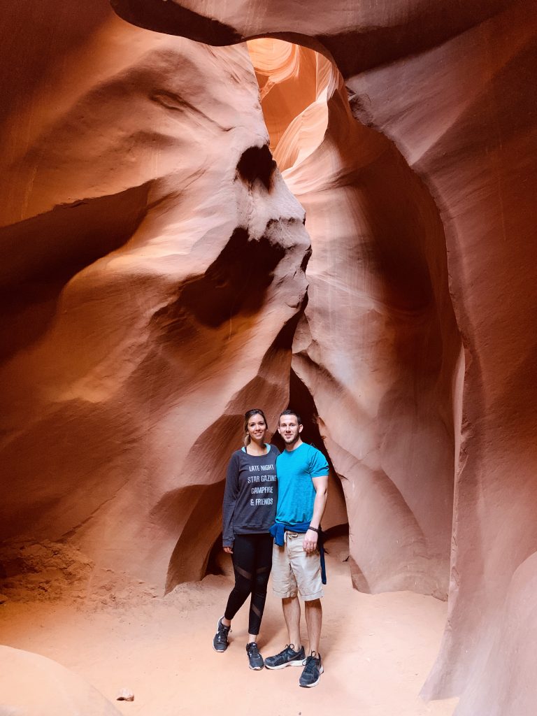
As you reach the sandy canyon floor, you’ll notice that it’s where the river flows during rainy season,. Flash floods fill the canyon walls and carve out the beautiful formations that you see in the picture below.
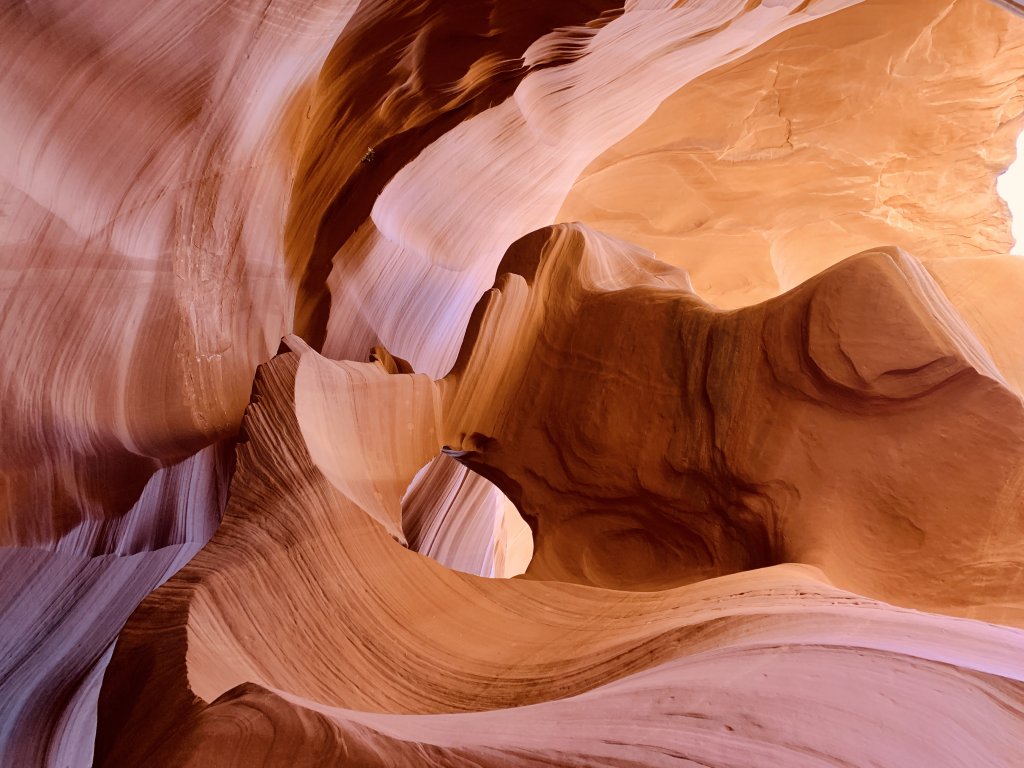
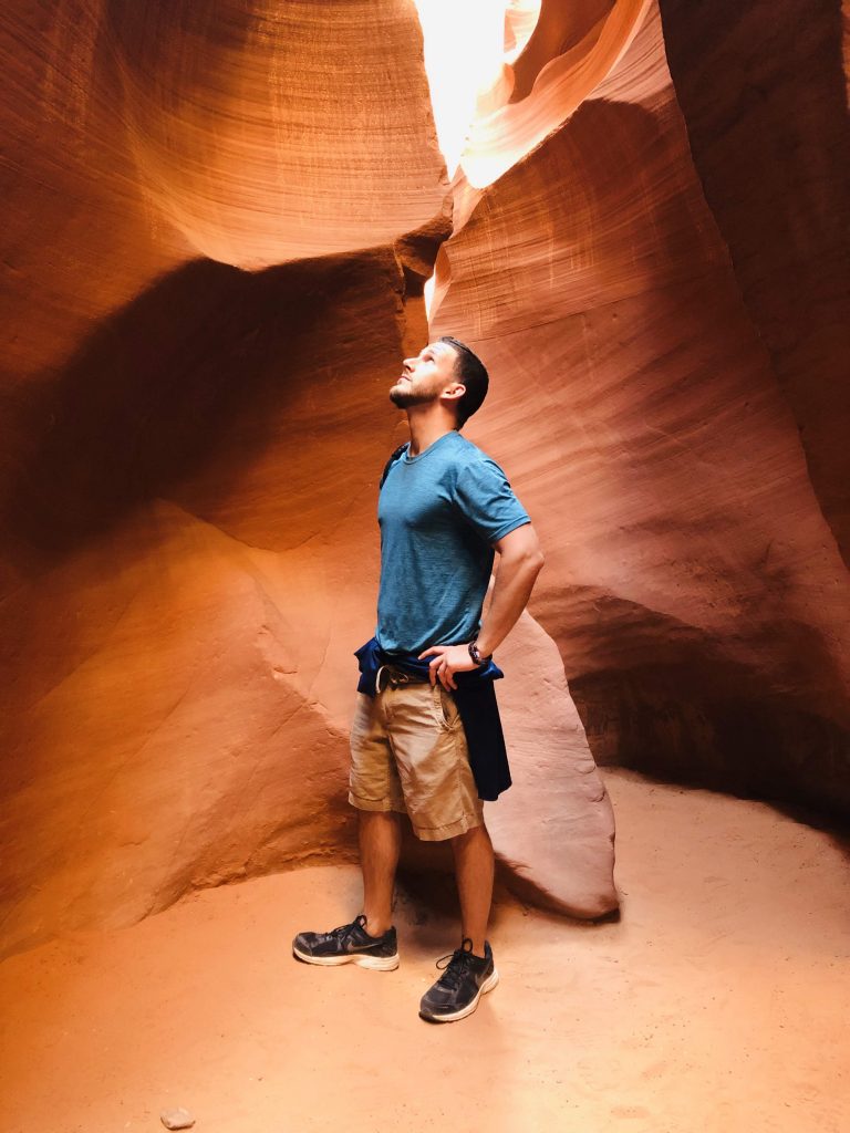
Our guide knew his script well as he gave us inside information on the history of the lower antelope canyon. In conclusion, the tour was about an hour long. Enjoy some more pictures below!
There is something to be said for the unknown. In other words, I wont give away all the details of inside the canyon because I want you to experience it on your own. Keep your expectations low and then you will not be disappointed. This place is worth the admission cost.
“A must-see-bucket-list item.”
I would love to visit the Upper Antelope Canyon. If you do, please write down in the comments below and tell me how you liked it!
Horsehoe Bend
If your day has just began, you are probably up for more adventure. After the tour concludes of the Lower Antelope Canyon, take a short ten minute drive to Horsehoe Bend. Horseshoe Bend is also located in the town of Page Arizona.
A word of caution, Horseshoe Bend is becoming an overpopulated tourist trap. The new parking lot, built in 2018, charges vehicles to park near the bend. Visitors to the Horseshoe Bend Overlook will also be required to pay entrance fees determined by City of Page Resolution #1224-19, effective immediately, as follows:
- Motorcycle: $5
- Passenger vehicles (car, truck, SUV, RV, motorhome): $10
- Commercial vans with passenger capacity of 14 or less: $35*
- Mid-sized commercial and tour buses with passenger capacity of 15-35: $70*
- Full-size buses with passenger capacity of 35 or more: $140*
“Those planning trips to Page, AZ, and Horseshoe Bend are reminded that if they find all official parking areas to be full at the time of their visit, they will be required to return at another time when they can find available space. Parking on the side of US89 is strictly prohibited.

After you pay the parking fee, you might want to hit the bathroom before the sandy hike uphill. You wouldn’t know you were anywhere special until you literally were about to fall into the canyon below.
Also. the sand is very hot in the summer. While it might be tempting to wear hiking sandals, like you would at Lake Powell, there is no water in which to cool your feet. You can seriously burn your skin from the sand, so in the summer, make sure you’re wearing closed-toe shoes. Other times of year, I suppose you could wear your sandals – just use your best judgement.
I would highly recommend getting a GoPro and a GoPro Selfie Stick to get some epic shots without getting too close to the edge. And I’m saying, but not saying, I’ve seen some epic drone shots with the DJI Mavic Pro here!
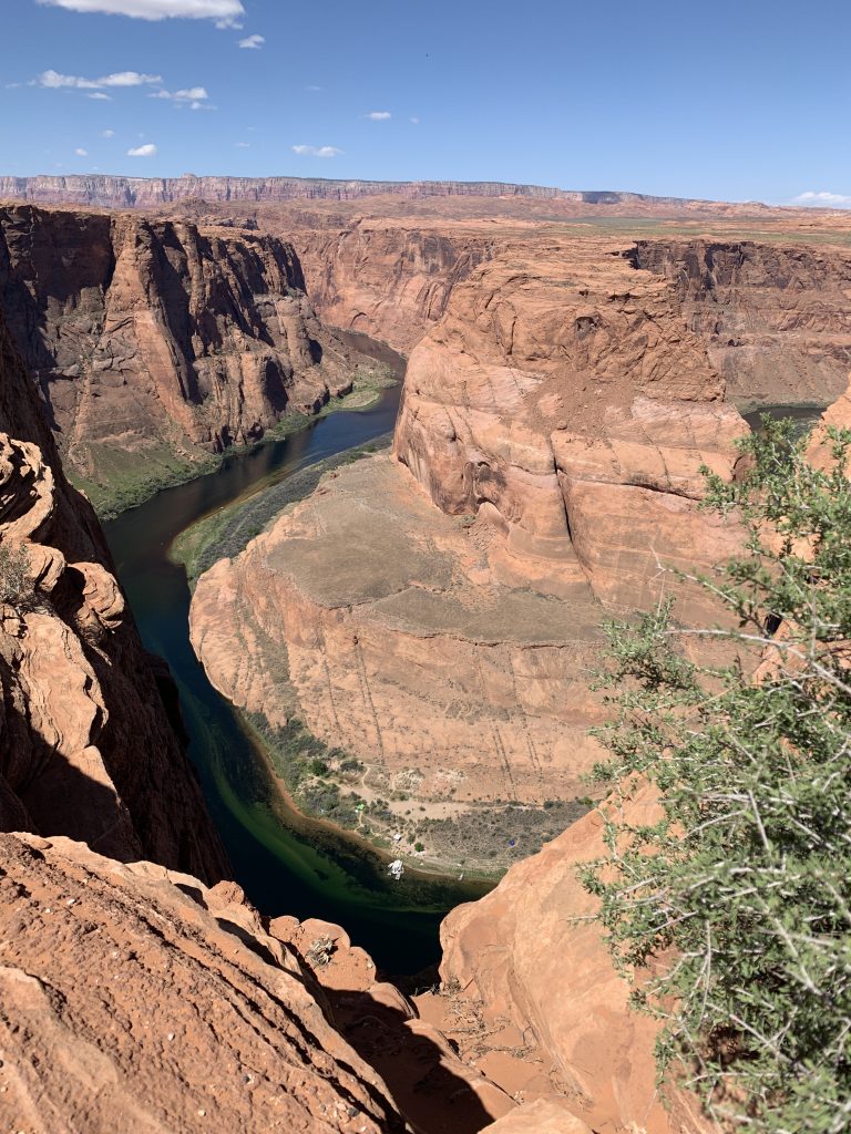
The bend is sweet and you could spend a few hours here if you packed a lunch or just really enjoy walking around the stunning views.
If you walk a little north you will find higher rock formatiosn. You can choose to scale the wall, like I did, or pass by it and take the “stairs” on the other side. These rock formations had to be an additional 30-50 feet in the air overlooking the landscape. You could really see for miles on the top on a clear day. Que the video clip from Lion King where the monkey holds young Simba above everybody on Pride Rock.
To me, Horsehoe Bend was a cool spot but not somewhere where you need to spend more than an hour. Unless, you want to turn into scrambled eggs for the vultures. It might be a good spot to stargaze but we were there in the early afternoon. And, early afternoon is actually the best time to go. Go too early or too late and the Colorado River below is in the shadows and hard to see.
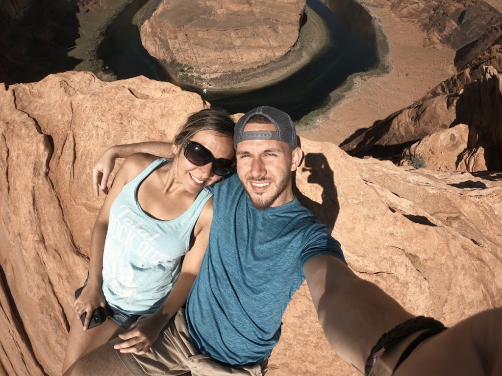
Horseshoe Bend is open from dawn until dusk, daily, besides for Thanksgiving, Christmas and New Years Day.
Bryce Cannon
Over two million visitors come to experience the otherworldly magic of Bryce Canyon National Park each year, most between March and early October. Most will visit for at least one full day. However long your visit, advance planning will have the greatest benefit in making the most of your time. Much like the rest of this guide, planning a head of time is key. Planning ahead does not mean you have to plan every day of every hour with jam packed adventure. Likewise, you should plan for downtime too, it’s just as important.
Park Fees
The cost of getting into the park via car is $35. If you’re coming on foot, it’s $20 per person. The fee covers you for an entire week, which is a great value if you’re planning on being there for a few days.
The Highlights of a Visit
Bryce Canyon is not a single canyon, but a series of natural amphitheaters or bowls, carved into the edge of a high plateau. The most famous of these is the Bryce Amphitheater (pictured below), which is filled with irregularly eroded spires of rocks called hoodoos. Perhaps every visitor to the park will spend at least some time marveling at its four main viewpoints, all found within the first few miles of the park: Bryce Point, Inspiration Point, Sunset Point, and Sunrise Point. Between April and October a shuttle service is operated in this area of the park to reduce congestion.
Other viewpoints are found all along the park’s 18-mile main road which travels from park’s only entrance in the north along the plateau rim to its highest elevations in the south (over 9,000 ft / 2,743 m).
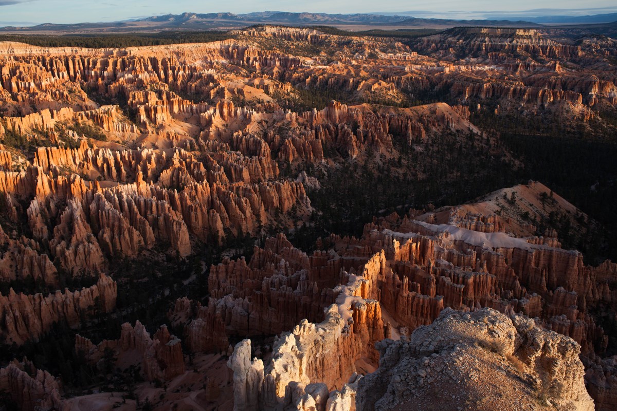
Hiking trails explore the forests of the plateau, connect between viewpoints along the rim of the Bryce Amphitheater, and wander through the hoodoos below.
If you’re into horseback riding, like I am, see the visitor center to explore Bryce Canoyon by horseback!
Bryce Canyon offers two campground sites (one in winter) and lodging is available at the Bryce Canyon Lodge during the summer season. During winter, hotel rooms are available in the park at the Sunset Hotel.
Explore the park map to begin familiarizing yourself with the layout of this special place.
Again, you cold spend multiple days here if you wish as there is a ton to explore. But for the sake of our road trip, let’s move on to the next must-see site.
Zion National Park
If I would’ve known the beauty of our next destination, I would’ve came here years ago.
How did I not hear of Zion National Park sooner?!
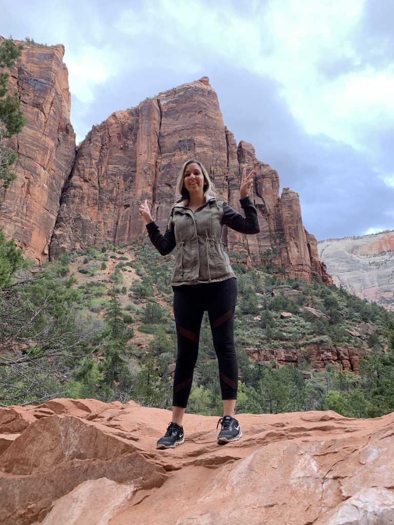
More than likely you will arrive in Springfield, at the base of Zion. Zion feels much like you’re on another planet! The massive sandstone cliffs of cream, pink, and red that soared into a brilliant blue sky were astonishing. The clouds above casting shadows on the rock formations were something to be seen. No picture will ever do it justice, its incredible.
Zion’s unique array of plants and animals will enchant you as you absorb the rich history of the past and enjoy the excitement of present day adventures.
I use hotels.com to book all of my hotels. Turns out, Hampton Inn & Suites, is the perfect location. it’s right across the parking lot to the visitors center. Stop in to the visitor center for all the information you need on Zion National Park. Zion has a nice shuttle bus system, similar to the Grand Canyon.
The park has three campgrounds. South and Watchman Campgrounds are in Zion Canyon. The Lava Point Campground is about a 1-hour drive from Zion Canyon on the Kolob Terrace Road. There are no campgrounds in Kolob Canyons. Camping is permitted in designated campsites, but not in pullouts or parking lots. Camping is popular; all campgrounds are often full by mid-morning. From mid-March through late November the campgrounds are full almost every night.
Getting to the Park and The Information Center
The shuttle bus runs up and down the Main Street, taking you from the street of Springfield to the park entrance. The most important thing to be aware of is the weather for the day. The second most important thing is knowing what trails are closed. It also helps to know the shuttle bus schedule. All the answers to these questions can be found at the visitor center. If you really want to be prepared, plan your hikes the night before.
Note: From early February through late August, visitation at Zion is extremely high.
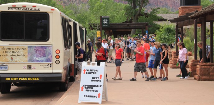
There may be significant delays entering the park, and once inside there is limited parking. Parking is usually full by 8-9 am. The best way to avoid delays entering Zion is to park in Springdale and ride the free shuttle to the park.
Zion National Park is open 24 hours per day, every day of the year, and no reservations are required to visit.
If you do visit during peak season, expect to see a lot of other people on the trails and shuttle. It is not uncommon for hundreds of people to hike to Angels Landing or The Narrows. The following holidays and weekends are especially busy:
1. Memorial Day (last Monday in May)
2. Easter week (date varies – usually in April)
3. Labor Day (first Monday in September)
4. Utah Education Association break (4 days in October, visit www.myuea.org for details)
Park Fees
Just like Bryce Canyon, the cost of getting into the park via car is $35. If you’re coming on foot, it’s $20 per person. The fee covers you for an entire week, which is a great value if you’re planning on being there for a few days.
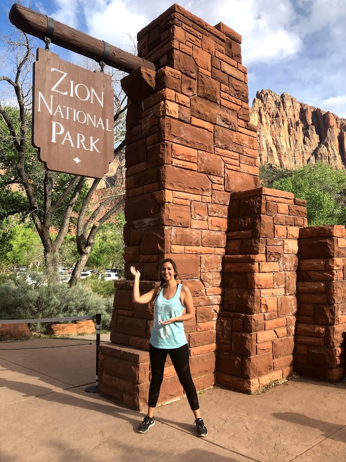
Savings Tip: Always say you came in a car to avoid paying $5 extra. Or, go to the park on National Park Day and its FREE!
After paying the entry fee, hop on Zion’s shuttle bus service. Not to be confused from the Main Street shuttle bus service. This bus specifically drives in Zion National Park and that is it.
Depending on what trail and where you would like to hike, depends on what stop you are going to get off at. Each shuttle bus plays a recording with history and information about each stop, in addition to announcing what stop is coming up and what stop you may be currently sitting at. Listen carefully as there is a lot of great information.
Personally, I have experienced three of the main trails at Zion National Park.
The Grotto & Weeping Rock
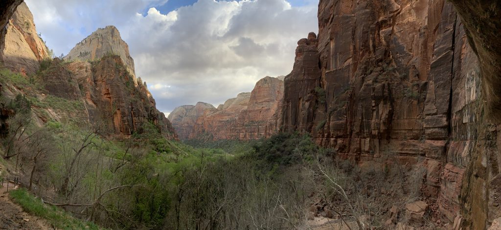
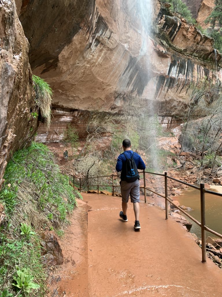
Both of these trails are short and sweet. They each feature half-mile hikes along gradual paved paths. Weeping Rock is just that, a giant rock formation that had dripping water falling from its jagged edges. You could expect more water depending on the time of year. Check out the picture below to get a glimpse of what I’m talking about.
The Grotto hike itself, is not much to talk about but it’s a good hike to get your legs ready for the more adventurous hikes. The view when you get to the end of the trail is pretty and gives you a good idea on what’s in store. On a clear day you can see a mile down the valley.
Speaking of more adventrous hikes…
Angel’s Landing
When I went to Zion, I went for one reason only, Angel’s Landing! Angel’s Landing is one of the most dangerous hikes in the world. In fact, many people have died making the climb.
If you’re planning on doing this hike, you must be prepared. The hike is strenuous and you must be in decent shape. If you want to have the most enjoyable time, be up early. Indeed, the early bird gets the worm. Otherwise, you will be fighting the crowds, which makes the hike less enjoyable and more dangerous.
Get a good nights sleep, wake up and be in line for the shuttle bus at Zion National Park when the first shuttle bus is scheduled to leave. You will notice that even though you were one of the first on the shuttle bus, when you get off at the Angel’s Landing stop, you will find others already way ahead of you. That’s because the park is never closed. So, those who chose to get a head start, did not wait for the shuttle bus and walked to the trail head instead.
When you do depart your hotel room or campsite, make sure to bring as little as possible. The heaviest thing you should be bringing with you is water. It would not be a bad idea to have a Camelback Hydration Pack. Protein bars and snacks are a great idea too. You will be burning a lot of calories and need to pay attention to your body. Again, people have died making this climb and it’s usually because they are taking selfies and not paying attention or body fatigue/exhaustion.
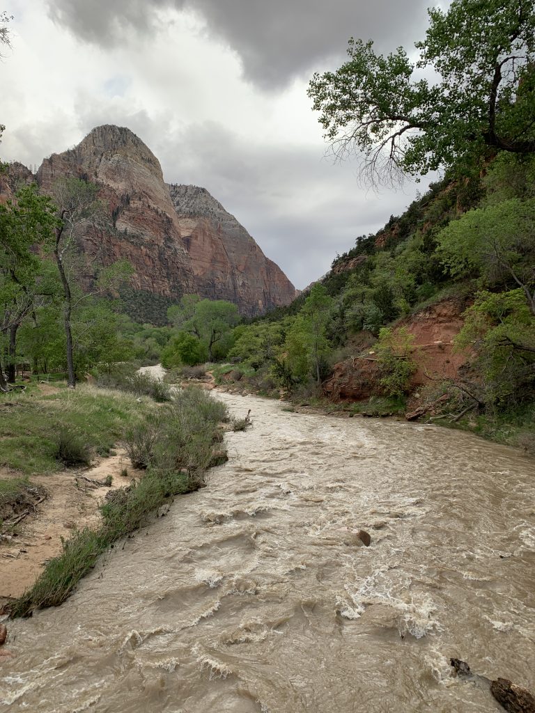
The bottom of the trail starts with a bridge walk across the river. Take a few minutes to work on your breathing here as things get tough if your not breathing properly, quickly.
West Rim Trail
The West Rim Trail completes the first two miles of the hike. It’s a steady, uphill climb on a wide, paved trail. Make sure to stop when you need to or to just appreciate the scenery. After a steady uphill walk, the trail enters Refrigerator Canyon. If you are expecting a place to stay cool and in the shade, this is your last chance. It’s the only shady part of the hike which is another reason to do the hike early if its going to be hotter later that day.
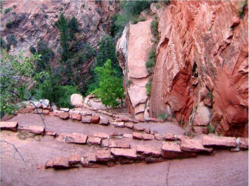
Walter’s Wiggles were next up and these 21 switchbacks are no easy feat. Prepare to feel the burn just before the half way point here. If you need to stop, don’t be embarrassed, as we saw a ton of people stopping every few switchbacks. I saw a few kids running up this section! Ahh, to be young again!
Scout’s Landing
Now that your red-faced and feet heavy, you’ll arrive at Scout’s Landing. Scout’s landing is where you get your first incredible view of the landscape and all that is Zion National Park. It was at this moment that made every single step worth it for me. I would do it again in a heartbeat for this view. If you’re feeling accomplished at this point, there is no shame in turning back. Otherwise, take a minute to put your backs up against the wall and enjoy the moment.
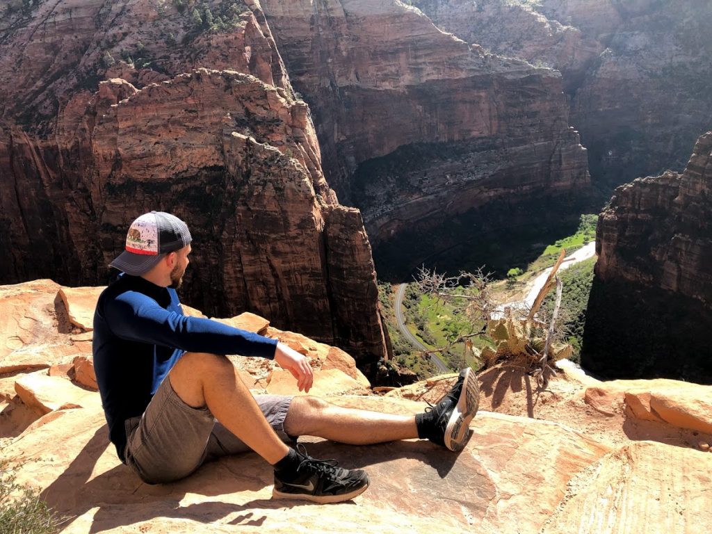
However, here is where things got really interesting. With chain-assisted rock scrambling sections, stunning views, and vertigo-inducing heights, this is the section that everybody talks about. There was no turning back after Scout’s Landing.
Hikers Tip: Keep stepping one foot after another, one hand after another. Never let go of the chain and watch your footing. Do not cross your feet.
“The Spine”
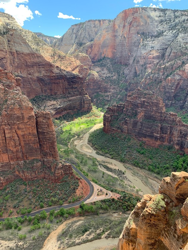
After Scout’s Landing, you will run into the spine of Angel’s Landing. Look to the left, look to the right, nothing but clean air. A 1,000ft drop separates you and the ground. Check out this short video clip to really get an idea of what it was like!
It’s a long way down from up here and the shuttle buses look like matchbox cars. And, just when you think you were at the top. one hundred fifty more feet to go!
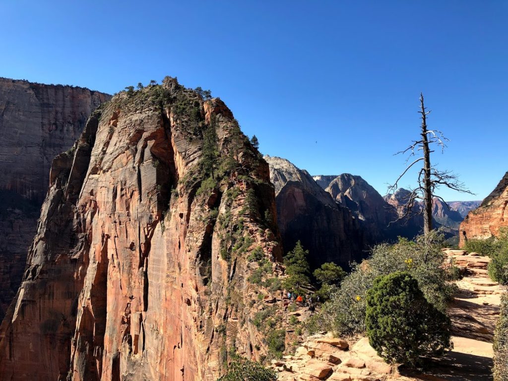
At this point you can see that the end is in sight. Don’t be surpirsed if you see Bald Eagle’s or Condor’s flying up this high. You will also notice the small chipmunks running around. They love to steal your food, keep it packed away or eat it!
Make sure to hydrate before the last leg of the hike, as its one heck of a fight to the top.
Making it to the top!
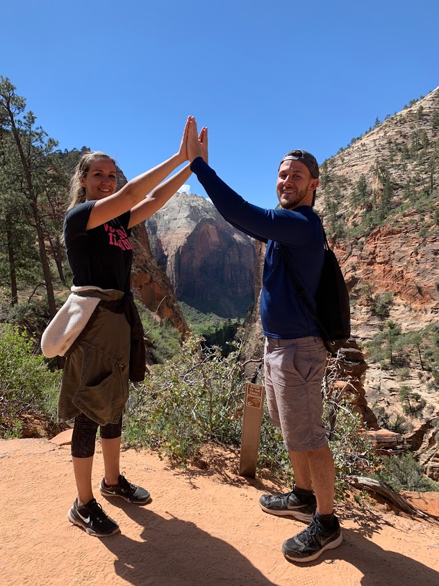
Once you make it to the top, enjoy the most amazing views you have ever seen in your life. It’s said that Angel’s Landing got it’s name because it was so high that only angel’s could land here. Have no fear though, you’re here!
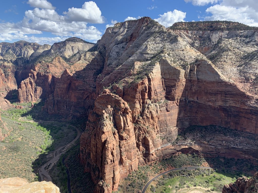
Enjoy your time at the time before the crowds really start to take over. I’d recommend heading down before 11:30am because you’re literally fighting people to get back down the spine. You do not want to be rushed making your way back down. Go at your own pace and take your time.
If you hike up at a decent pace and reach the top before 10:30am, it’s conceivable you could reach the bottom by noon. If Angel’s Landing is the only thing in your plans for the day. Stay at the top and enjoy the views or pack a lunch.
The Narrows
The Narrows are another really popular hike in Zion. It’s the narrowest section of Zion Canyon. The gorge, with walls a thousand feet tall and the river sometimes just twenty to thirty feet wide, is a site to see. You can see The Narrows by hiking along the paved, wheelchair accessible Riverside Walk for one mile from the Temple of Sinawava. If you wish to see more, you will be walking in the Virgin River. This can involve wading upstream for just a few minutes or it can be an all day hike. Weather and time of year is really a factor when making this hike.
Most people hike The Narrows in the late spring and summer when the water tends to be at its warmest and the water level drops. However, this is also the time of year that storms can cause life-threatening flash floods.
Close-toed shoes and a hiking stick are recommended for hiking on the slick, uneven rocks in The Narrows. High canyon walls and water create cooler conditions than anywhere else in Zion Canyon, so wear and bring seasonally appropriate synthetic layers.
Hoover Dam & Lake Mead
It’s possible to visit the Hoover Dam and Lake Mead before or after your stop in Vegas. The Hoover Dam is a concretearch-gravity dam in the Black Canyon of the Colorado River, on the border between the U.S. states of Nevada and Arizona. It was constructed between 1931 and 1936 during the Great Depression. Over one hundred lives were lost in the making of the dam. Originally known as Boulder Dam from 1933, it was officially renamed Hoover Dam, for President Herbert Hoover.
The dam is free to view or you can sign up and pay for a guided tour ranging from $10-$30 per person on the Hoover Dam website.
Hoover Dam – Open to the public everyday from 5:00 a.m. to 9:00 p.m.
Hoover Dam Tours – Open everyday from 9:00 a.m. to 5:00 p.m. The information that you need to plan your trip. Here is where you will find a description of the tour, admission fees, directions and more. Hoover Dam Tours are closed two days per year in observance of Thanksgiving and Christmas Day.
Personally, I thought it was a great experience just visiting on my own and saving the cash. You can walk around and get great views.
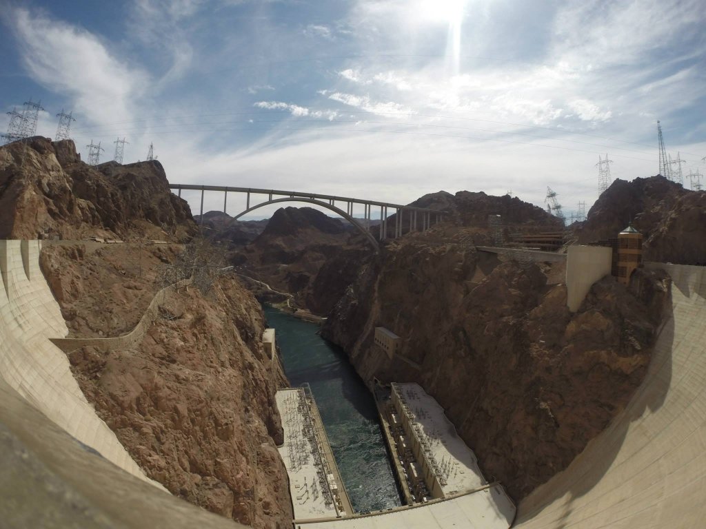
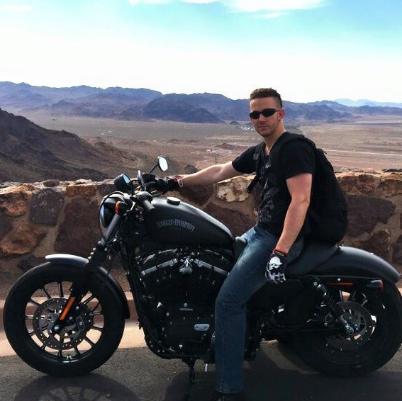
The ride into the dam was extra special, as I was riding on a Harley Davidson Sportster motorcycle at the time. Although, if you’re planning on riding a motorcycle anywhere near Las Vegas, Arizona, etc., wear a helmet or a face mask. The wind in combination with the sand feels like a hairdryer blowing the beach on your face. It’s unpleasant to say the least. However, being on the bike never gets old. The freedom, the wind, the smell of fresh air and the power between your legs.
After the Hoover Dam, it’s time to stop and relax at Lake Mead.
America’s First National Recreation Area
Swim, boat, hike, cycle, camp and fish at America’s first and largest national recreation area. With striking landscapes and brilliant blue waters, this year-round playground spreads across 1.5 million acres of mountains, canyons, valleys and two vast lakes. See the Hoover Dam from the waters of Lake Mead or Lake Mohave, or find solitude in one of the park’s nine wilderness areas.
There is one national park just minutes from Las Vegas that has Joshua trees, slot canyons and night skies illuminated by the Milky Way. One national park where the rocks are as red as fire and the mountains are purple majesties.
Check out the many things to do;
- Discover the many marinas and coves at Lake Mead.
- Pitch a tent or pull up your RV and stay the night in the park.
- With more than 290 square miles of water surface, you can be sure to find a favorite spot to catch the big one.
- Take a hike along one of Lake Mead’s many trails.
Vegas Baby!
The famous saying “whatever happens in Vegas, stays in Vegas” leads to be true every single time. Sin city is the capital of party USA. The Bellagio on South Las Vegas Boulevard is the hotels of hotels. It’s Vegas’s grand jewel. It’s one of the most famous places to be on the strip. Inside is huge and one could easily get lost…like, within one hour. I don’t know what it is, the cocktails or fresh oxygen pumped in the air, but I got lost in the glitz and glamour in no time at all. Flashing neon signs, casinos, restaurants, night clubs and shopping everywhere.

If you’ve never been to Vegas before, it’s paramount that you spend at least a few hours walking down the strip with drinks in hand and admiring all the people that you will see; Dopplegangers, families, honeymooner’s, Elvis, Spiderman and strippers, oh my!
Note: “The Strip”, as its commonly referred to, is South Las Vegas Boulevard.
After a long stroll down the strip, you will want to relax so I hope you will be vising in the summer months. The pool will sound good after your feet are sore from walking. However, the most fun I’ve ever had in Vegas was at a pool party at Wet Republic. It was insane! Beach balls, flying foam, a live DJ and a packed house.
But if that’s not your style, what I am saying is, make sure to book a hotel with at least a pool. It’s nice to sit at and relax after a long walk down the strip. Conversely, it’s usually a good time if you’re looking for some fun as well.
One of the reasons I stayed at the Bellagio is because of the massive wave pool. It’s one of the biggest and best pools in Vegas.
The Wave Pool
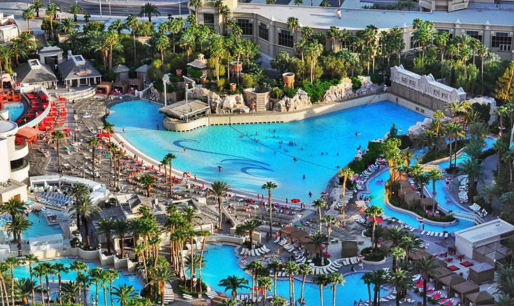
So, soak up the sun, grab a drink or take a nap by the wave pool.
It’s almost a written rule to take a nap sometime during the day when vising Vegas. They say its the city that never sleeps, which is true, because you’re out all night. But, to be able to stay out all night, you want to make sure to at least get in a cat nap before dinner.
Mandalay Bay Fountain
One of the sites to see along the strip at night is the Mandalay Bay Fountain. The fountain lights up and synchronizes to a music playlist. The choreography is always entertaining and something everybody needs to see, It’s short and sweet and usually lasts a few minutes or so.
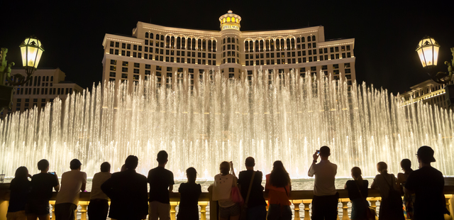
If you’re wondering what else to see on the strip besides the many restaurants, here’s a short list;
- Mandalay Bay Fountain
- Fremont Street
- Venetian Hotel and Gondola Rides
- Paris Hotel and the Eiffel Tower
- Mirage Hotel: Erupting Volcano and Secret Garden
- High Roller Ferris Wheel on the Linq
- New York-New York Hotel
- Caesar’s Palace and The Colosseum
- Shark Reef Aquarium
- Neon Museum
- Stratosphere Tower
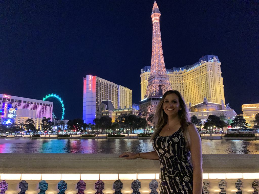
The Eiffel Tower and Paris Hotel can be seen in the background of the photo above.
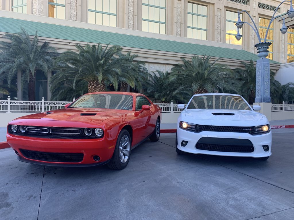
Aside from The Strip attractions, Vegas has other nearby activities for the adventure enthusiast including: helicopter rides, Harley Davidson rentals, Supercar racing and off-road racing adventures.
Quick Example Itineraries
7-Day Trip
- Red Rock State Park/Devil’s Bridge
- Sedona
- Sedona/Flagstaff
- Grand Canyon
- Antelope Canyon
- Zion National Park
- Vegas
8-Day Trip
- Red Rock State Park/Devil’s Bridge
- Sedona
- Sedona/Flagstaff
- Grand Canyon
- Antelope Canyon
- Zion National Park
- Zion National Park
- Vegas
10-Day Trip
- Red Rock State Park/Devil’s Bridge
- Sedona
- Sedona/Flagstaff
- Grand Canyon
- Antelope Canyon
- Bryce Canyon
- Zion National Park
- Zion National Park
- Vegas
- Vegas
2-Week Trip
- Red Rock State Park/Devil’s Bridge
- Sedona
- Sedona
- Flagstaff
- Flagstaff
- Grand Canyon
- Antelope Canyon/Horsehoe Bend
- Bryce Canyon
- Bryce Canyon
- Zion National Park
- Zion National Park
- Vegas
- Vegas
What other questions do you have about Arizona, Utah or Vegas? Leave a comment in the section below.
Book Your Trip Now!
Below are my favorite companies I use time and time again when I book my travel.
- Travel Coupons & Discounts – Get Cash Back at places like Hotels.com, Expedia, Travelocity, Priceline and many more with Rakuten. Sign up today & get $30!
- My Favorite Travel Credit Card – Chase Sapphire Prefered. This is by far the best way to book travel and earn miles/points while doing so. Use the Chase Sapphire Prefered for booking 3x travel, 3x dining and 3x on streaming services.
- My Second Favorite Travel Credit Card – In my opinion, the second best travel rewards credit card, the Capital One Venture. Use the Capital One Venture card for 2x the rewards on everyday purchases.
- Rental Cars – Search, compare and save on the best rental car company brands all in one place using DiscoverCars.
- Booking.com – Booking has the widest selection of budget accommodation in the world. In our studies, they constantly found the cheapest rooms. I also like their easy-to-use interface and no-money-down policy.
- Hotels.com – Hotels.com is my second choice for finding hotels. I love their selection and easy to navigate website. Use it often for free hotel stays with OneKeyCash.
- VRBO – The most popular vacation rental site in the US. ✓+2 million rentals worldwide ✓19+ million reviews ✓Secure online payment
- Selina Hostel – This is the best hostel accommodation in the world. Their unique CoLive stays, artwork and location are the best. Not to mention, they are a great value travel brand!
For companies, check out my favorite travel companies section that includes even more of my favorite travel companies that will help you value travel!



 Previous Post
 Next Post



What an awesome road trip! I have done the beginning and end but have yet to see the sights in between. Adding this for one of my next road trips as the landscapes look gorgeous!
Vanessa, they are some of the best landscapes I’ve ever seen. My favorite part was Zion National Park, I can’t recommend going there enough. Let me know what you think if you end up making it there 🙂
The landscape is really incredible. The rocks are so giant. I love the road trips, you can see so much..
I prefer road trips over anything else to be honest. You get to go at your own pace, stop when you want, see what you want and for how long you want. It’s a win-win situation for me.